 DustBot
Autonomous Navigation: How Robots Find Their Way
The Navigation Problem
For a human, walking from one end of a street to the other is trivial. For a robot, it requires solving at least four problems simultaneously: determining its current position, building or accessing a map of the environment, planning a collision-free path, and executing that plan while responding to unexpected obstacles.
The DustBot project tackled all four in the context of narrow Italian streets, and the solutions its engineers developed remain instructive for anyone studying outdoor robot navigation.
Localisation: Where Am I?
The most fundamental question a mobile robot must answer is its own position. DustCart used differential GPS (DGPS) as its primary localisation method. Standard GPS provides accuracy of roughly 2–5 metres — acceptable for car navigation but useless for a robot that needs to stay on a 1.5-metre-wide pavement.
Differential GPS improves on this by using a fixed base station with a known position. The base station calculates the error in GPS signals and broadcasts corrections to the robot in real time. DustCart achieved positioning accuracy of approximately 2 centimetres using this approach — sufficient for navigating Peccioli’s streets.
The limitation, of course, is sky visibility. In narrow streets with tall buildings, GPS signals bounce off walls and arrive at the receiver along indirect paths. This multipath effect can degrade accuracy dramatically. The DustBot team supplemented DGPS with laser rangefinder data to maintain positioning in GPS-challenged areas.
SLAM: Building Maps on the Move
Simultaneous Localisation and Mapping — SLAM — is the technique of building a map of an unknown environment while simultaneously tracking the robot’s position within it. It is one of the most studied problems in mobile robotics, and for good reason: it is a chicken-and-egg problem. You need a map to know your position, and you need your position to build a map.
SLAM algorithms resolve this through probabilistic methods. The robot takes sensor readings (from LiDAR, cameras, or sonar), matches features between successive readings, and incrementally builds a consistent map while correcting its estimated position. Extended Kalman Filters and particle filters were the dominant approaches during the DustBot era. More recently, graph-based SLAM methods have become standard.
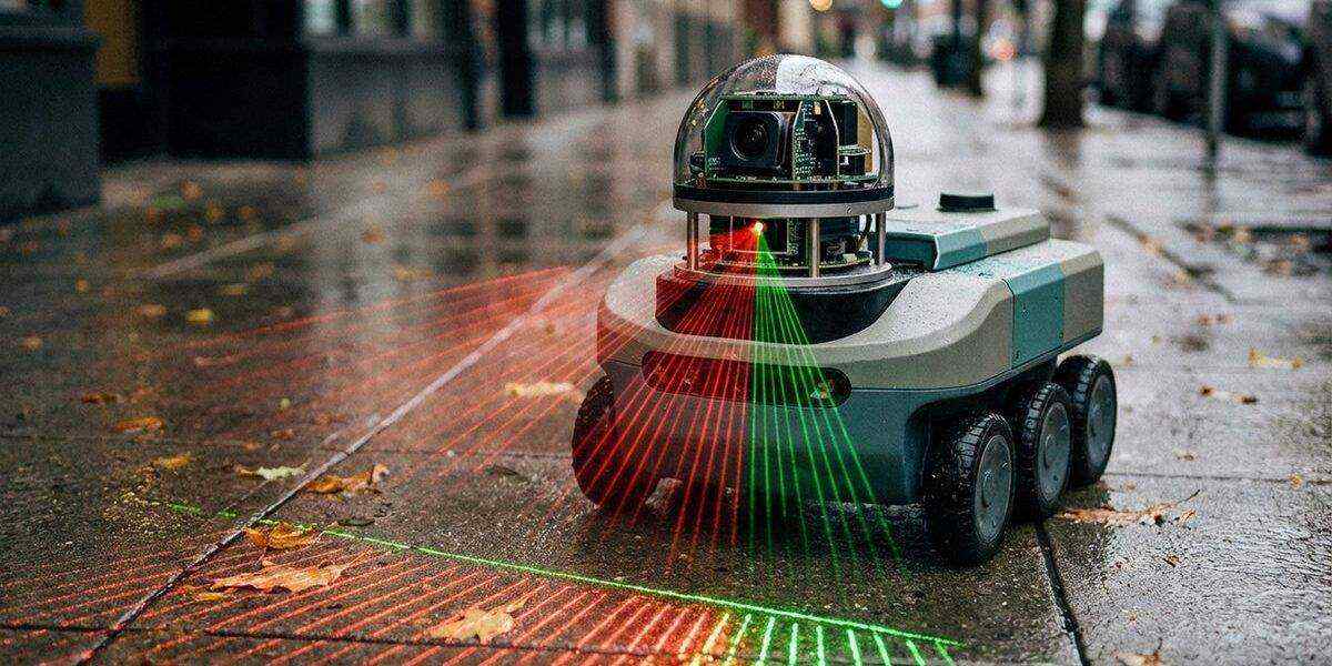
DustClean used a 2D laser scanner to perform SLAM in its operating environment, creating occupancy grid maps that distinguished between free space, obstacles, and unknown areas.
Path Planning: Getting from A to B
With a position fix and a map, the robot needs a plan. Path planning algorithms range from simple grid-based approaches (A*, Dijkstra’s algorithm) to more sophisticated methods that account for the robot’s physical dimensions and turning constraints.
DustCart used a layered planning approach. A global planner computed the overall route between the robot’s current position and its destination, using a pre-mapped road network. A local planner handled real-time obstacle avoidance along that route, adjusting the robot’s trajectory to avoid pedestrians, parked vehicles, and other transient obstacles.
This two-layer architecture — global planning plus local reactive control — remains the standard approach in outdoor mobile robotics. Modern platforms like Nuro use far more sophisticated versions, incorporating machine learning for prediction of pedestrian movement, but the fundamental structure is recognisably the same.
From the Lab: The Cobblestone Problem
During my postdoc years, I spent a frustrating month trying to get a wheeled robot to maintain odometry on cobblestone surfaces. The irregular stones caused constant wheel slip, and our dead-reckoning estimates drifted wildly within metres. The DustBot team faced this in Peccioli, where many streets are paved with centuries-old stone. Their solution — relying primarily on DGPS with laser-based correction rather than wheel odometry — was pragmatic and effective. It taught me that sometimes the best engineering is knowing which sensor to trust and which to ignore.
Sensor Fusion
No single sensor provides reliable navigation data in all conditions. GPS fails in covered areas. Cameras struggle in low light. LiDAR cannot identify the type of obstacle it detects. The solution is sensor fusion — combining data from multiple sources to produce a more robust estimate than any individual sensor could provide.
DustCart fused differential GPS, laser rangefinder scans, and inertial measurement unit (IMU) data. The IMU — a set of accelerometers and gyroscopes — provided short-term position and orientation estimates that bridged gaps in GPS coverage. The laser scanner detected obstacles and provided relative position data that could correct drift in the IMU.
Modern service robots have access to far richer sensor suites. Solid-state LiDAR, stereo cameras, and ultra-wideband positioning have all become affordable enough for commercial platforms. But the principle of fusion — trusting no single source completely — has not changed.
Challenges That Remain
Outdoor navigation for service robots is a substantially solved problem in structured environments: car parks, dedicated lanes, campus pathways. In unstructured environments — pedestrian zones, market squares, historic town centres — it remains difficult.
The main unsolved challenges include:
- Dynamic obstacle prediction — predicting where a pedestrian or cyclist will be in two seconds, not just where they are now
- Degraded GPS environments — urban canyons and indoor-outdoor transitions
- Semantic understanding — recognising that a queue of people at a bus stop is different from a static obstacle like a bollard
- Long-term map maintenance — environments change over weeks and months (construction, seasonal vegetation, temporary road closures)
These challenges explain why robots in urban environments continue to generate active research nearly two decades after DustBot’s field trials.
References
Mazzolai, B., Mattoli, V., et al. (2008). “DustBot: a networked system of autonomous robots for urban hygiene.” Proceedings of CLAWAR 2008.
Thrun, S., Burgard, W., Fox, D. (2005). Probabilistic Robotics. MIT Press.