Robot Sensors: The Technology Behind Machine Perception
Sensing the World
An autonomous robot without sensors is a motorised paperweight. Every decision a mobile robot makes — where to go, what to avoid, when to stop — depends on data from its sensor suite. The DustBot project used sensors that were state of the art in 2007. Understanding them provides a baseline for appreciating how far the field has advanced.
Laser Rangefinders (LiDAR)
LiDAR — Light Detection and Ranging — measures distance by emitting laser pulses and timing their reflections. Both DustCart and DustClean used 2D laser rangefinders, most likely SICK LMS series units, which were the standard for mobile robotics in the mid-2000s.
A 2D laser scanner sweeps a single plane, typically at hip height, producing a fan-shaped distance profile. This is sufficient for detecting walls, bollards, parked cars, and pedestrian legs, but it cannot see objects above or below the scan plane. A kerb, a low wall, or a hanging sign might be invisible.
Modern LiDAR has moved to 3D scanning. Multi-beam units like those from Ouster and Hesai provide 360-degree point clouds with vertical resolution, giving robots a three-dimensional understanding of their surroundings. The cost has dropped from tens of thousands of pounds to under a thousand for solid-state units suitable for low-speed robots.
GPS and Differential GPS
Global Positioning System receivers triangulate position using signals from orbiting satellites. Standard GPS accuracy of 2–5 metres is inadequate for pavement navigation. DustCart addressed this with differential GPS (DGPS), using a fixed base station to broadcast correction signals.
The base station, positioned at a known location, computes the error in each satellite signal and transmits corrections to the robot via radio link. This technique reduced DustCart’s positioning error to approximately 2 centimetres — sufficient for navigating streets 3–4 metres wide.
RTK (Real-Time Kinematic) GPS, a more advanced form of differential correction, is now standard in commercial outdoor robots. RTK achieves centimetre-level accuracy using carrier-phase measurements rather than code-phase, and is available through commercial services like Trimble and u-blox.
Inertial Measurement Units
An IMU contains accelerometers (measuring linear acceleration) and gyroscopes (measuring rotational velocity). By integrating these measurements over time, the robot can estimate its position and orientation — a process called dead reckoning.
IMU-based dead reckoning drifts over time as small measurement errors accumulate. It is not a standalone localisation solution. Its value lies in bridging gaps: when GPS loses lock (under a bridge, between tall buildings) or when LiDAR data is temporarily ambiguous, the IMU provides short-term continuity. DustCart used IMU data in exactly this way, as part of its sensor fusion architecture.
Cameras and Computer Vision
DustBot made relatively limited use of cameras compared to modern systems. The project’s navigation relied primarily on LiDAR and GPS. Current robots, by contrast, are heavily camera-dependent. Starship’s delivery robots use nine cameras for 360-degree visual coverage. Tesla’s autonomous driving system relies almost entirely on cameras.
Camera-based perception offers rich information — colour, texture, semantic content (is that object a person, a dog, or a dustbin?) — but requires computationally intensive processing. Deep learning models for object detection and semantic segmentation were not mature during the DustBot era. Their availability since roughly 2015 has transformed what cameras can do for mobile robots.
Gas and Environmental Sensors
DustClean’s environmental monitoring capability used two main sensor types:
- Electrochemical sensors — for measuring NOx, SO2, CO, and O3. These sensors generate an electrical current proportional to the gas concentration at the sensing electrode. They offer good sensitivity and selectivity for specific gases but have limited lifetime (typically 1–3 years) and are sensitive to temperature and humidity.
- Metal oxide semiconductor (MOS) sensors — for volatile organic compounds like benzene. MOS sensors detect changes in electrical resistance caused by gas adsorption on a heated metal oxide surface. They are less selective than electrochemical sensors — a single MOS sensor may respond to multiple gases — but are inexpensive and robust.
The challenge with mobile gas sensing, as discussed in our article on gas distribution mapping, is that sensor response times are slow relative to the robot’s movement. A reading at any given point reflects not just the current concentration but a time-averaged value influenced by what the sensor encountered in the preceding seconds.
Ultrasonic Sensors
Ultrasonic rangefinders emit sound pulses and measure the time-of-flight of echoes. They are inexpensive and effective for close-range obstacle detection (0.2–5 metres) but have limited range, wide beam angles, and poor performance in certain conditions — soft surfaces like clothing absorb sound rather than reflecting it.
DustBot likely used ultrasonics as supplementary short-range sensors for detecting obstacles too close for the LiDAR’s minimum range. Many current service robots retain ultrasonic sensors for this purpose despite advances in other technologies.
From the Lab: The Sensor You Forget About
In my experience, the most underrated sensor on any mobile robot is the wheel encoder. It simply counts wheel rotations, providing a basic distance measurement. It is the first sensor to fail on rough surfaces (wheel slip) and the last one you think to check when debugging navigation problems. During one particularly frustrating debugging session at Cambridge, I spent two days investigating a LiDAR calibration issue before discovering that a loose encoder cable was injecting random noise into the odometry. The lesson: always check the simple sensors first.
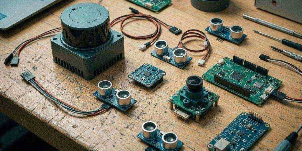
The Sensor Landscape in 2026
Modern service robots benefit from a sensor ecosystem that barely existed during DustBot’s development:
| Sensor | DustBot Era (2007) | Current (2026) |
|---|---|---|
| LiDAR | 2D, mechanical, ~10,000 EUR | 3D, solid-state, ~500 EUR |
| GPS | DGPS, dedicated base station | RTK via cloud service, ~200 EUR module |
| Cameras | VGA resolution, basic processing | Multi-megapixel, onboard deep learning |
| IMU | MEMS, moderate drift | MEMS, significantly improved drift |
| Compute | Embedded PC, ~1 GFLOP | GPU module, ~200 TFLOPS (NVIDIA Orin) |
The cost and capability improvements are staggering. What the DustBot team achieved with 2007 technology — navigating real streets, avoiding obstacles, monitoring air quality — is now possible with off-the-shelf components at a fraction of the cost.